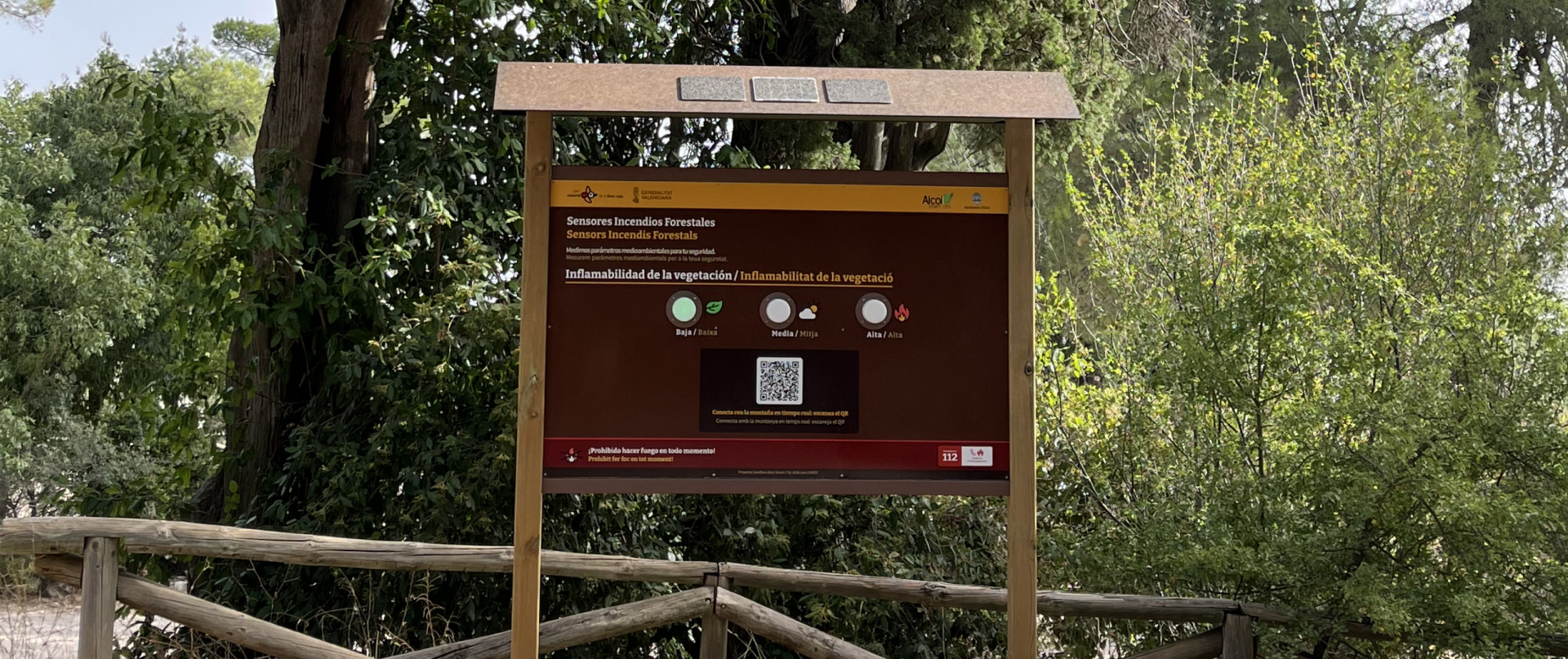
Font Roja protecting natural heritage through LoRaWAN-enabled smart Wildfire risk panel
The Font Roja Natural Park in Alcoy, Spain, stands as a resilient witness to the fragility of our ecosystems. Following the devastating wildfires in July 2025 that scarred the surrounding landscape, the memory of destruction serves as a reminder of the urgent need for protection.
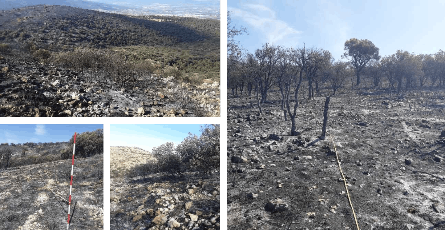
This environment demands a high standard of stewardship that goes beyond traditional boundaries, transforming our approach from passive observation to active, data-driven safeguarding.
The Font Roja Natural Park in Alcoy requires robust wildfire prevention strategies due to increasing climate change-induced risks like heat and drought. The primary challenge involves effectively monitoring hyper-local environmental conditions while fostering public awareness, ensuring that forest managers can act proactively while citizens remain informed and safe.
Our initiative innovates by blending advanced IoT technology with natural heritage through a reimagined information panel. Traditionally serving only as a static information board or map, the panel is now a smart, solar-powered information board, communicating information about wildfire risk levels in real time.
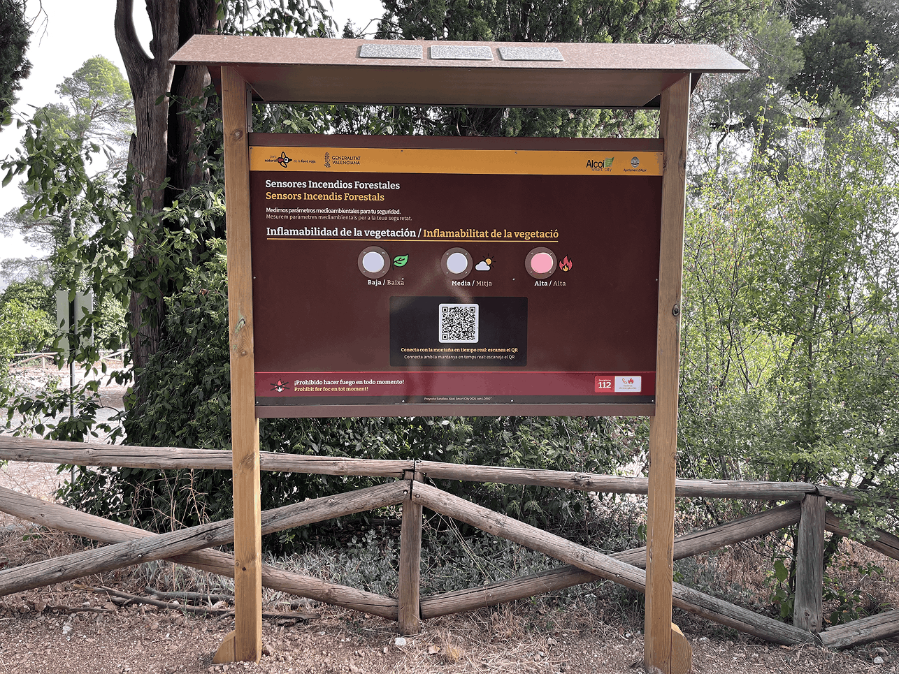
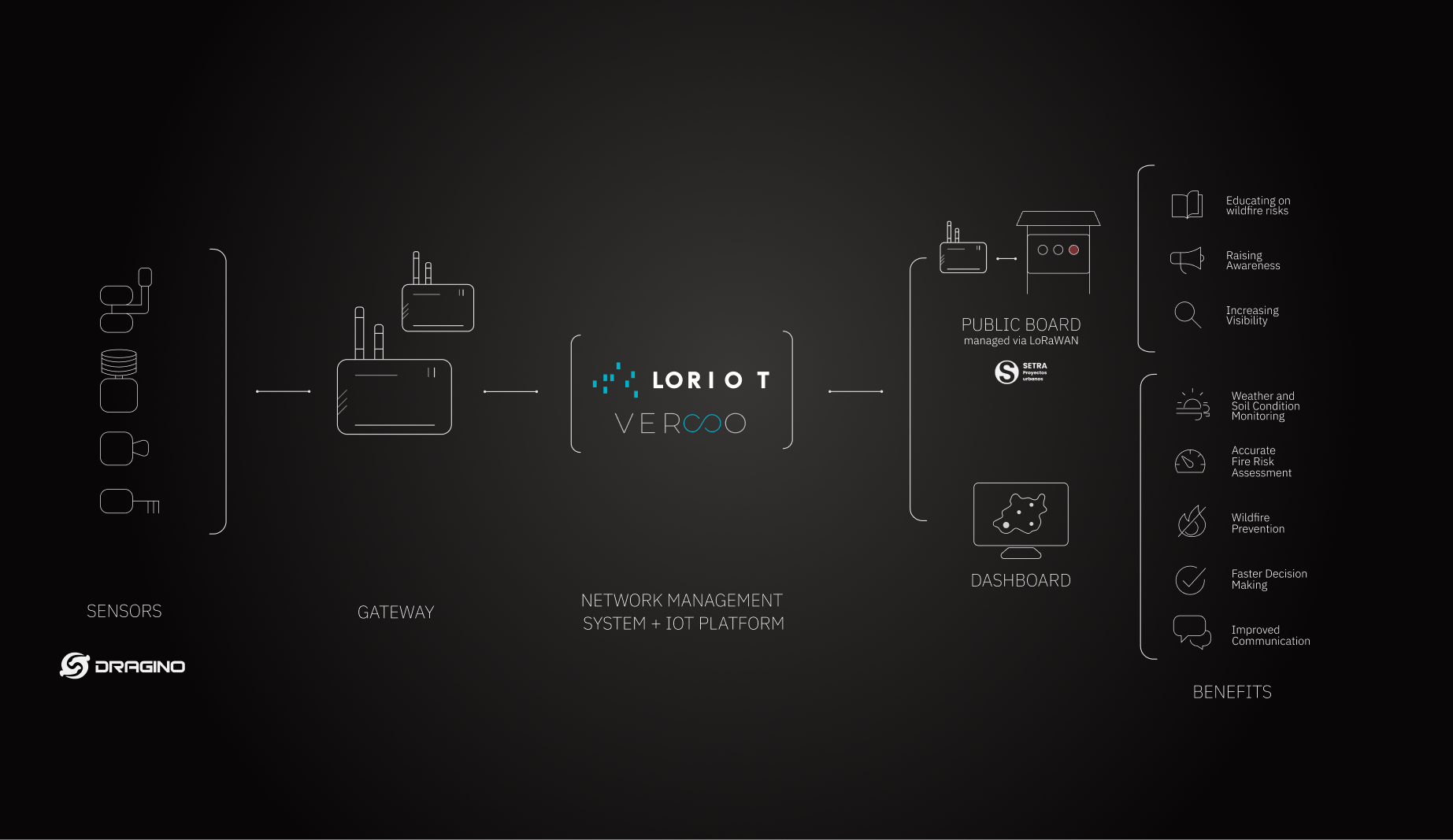
With Dragino sensors installed directly in the natural park, LORIOT Verso collects the necessary data to analyze in the cloud and calculates internationally recognized scientific wildfire risk index. This then translates into a clear wildfire risk level, unique to each area of the park.
Through intelligent warning lights and an interactive QR code on the panel, visitors receive visual real-time information about the current wildfire risk and can access a digital dashboard. This allows them to connect with the natural park by exploring environmental measurements and analyzing historical data from the past; understanding that this natural heritage is a “living organism”.
With our drive for innovation, together with SETRA SL we created the world's first panel that transformed 'old-school' totems into a dynamic tool for public engagement and safety.
"Thanks to LORIOT Verso, real-time sensor data gives us everything essential for fire prevention, rapid action, and keeping citizens informed about potential risks in our natural park."
Toni Francés
- Mayor of Alcoy, Spain.
At the heart of this initiative stands the smart totem, which serves as a beacon of transparency and safety. By bridging the gap between complex environmental data and public understanding, the totem transforms citizens into active protectors of the natural landscape. It provides immediate, intuitive visual alerts and empowers visitors to engage through an interactive digital interface, creating a model that fosters shared responsibility while delivering invaluable data for wildfire prevention strategies.
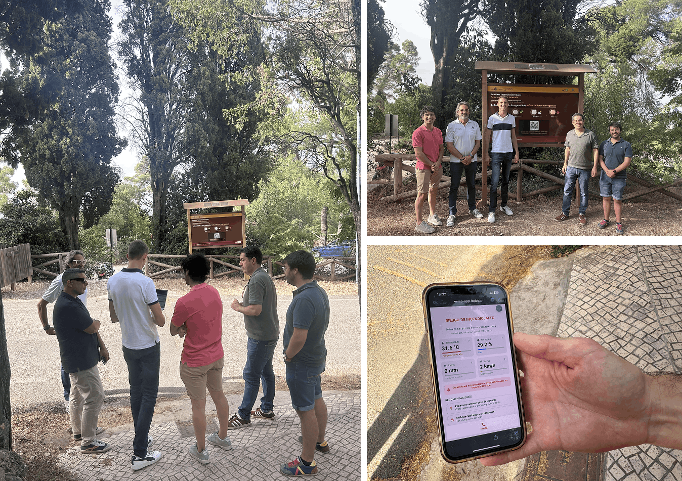
1. The City Council and forest guards gain access to detailed dashboards that analyze and summarize real-time data alongside historical trends, providing a clear overview for better preparation against heatwaves and wildfire seasons.
Amongst others, our platform provides:
The project supports multiple United Nations' Sustainable Development Goals (SDGs).











The true success of LORIOT Verso in this project is its ability to transform raw environmental data into tangible, aggregated, useful information. Useful for the administration and park rangers to make informed decisions, and useful for citizens to become active participants in protecting the park. It is deeply rewarding to transform months of hard work into a concrete deliverable. "
Robin Wulfes
- IoT Solutions Lead at LORIOT Verso.
LORIOT Verso is the IoT Vertical Solutions division focused on Environmental Monitoring and Disaster Prevention.
It provides end-to-end solutions for real-time data collection on climate, weather, soil, water, and air, helping predict and manage natural hazards like floods, fires, and droughts. Using high-tech sensors and long-range, low-power networks (LPWAN), it ensures scalable, sustainable, and secure data transmission from even remote areas. The platform enables interactive visualizations and decision-making tools to help mitigate environmental risks and damages. More details can be found here.