Protecting a city from flooding is rarely a question of a single river gauge. Rain falls on slopes several kilometres upstream, soaks into soil that may already be saturated, funnels into channels and basins, and only then becomes a number on a river level chart – often too late to do much more than react. Meanwhile, the decisions that matter most (when to open a retention basin, when to close a road, when to alert residents) are frequently made on the basis of regional forecasts, experience and a phone call.
With our solution we enable the transition from broad, regional flood warnings and reactive emergency response towards localized, real-time and anticipatory water management. By measuring the whole chain – how much rain falls, what the ground can still absorb, what the groundwater is doing and what the rivers and streets are actually carrying – operators gain the lead time to act informed and deliberately.
Benefits

We continuously monitor rainfall, soil saturation and water levels across the entire city area and surroundings. Emerging situations are visible before they reach the city, turning a chaotic response into an organized intervention.

Releasing or holding a retention basin is a high-stakes call. Our system replaces estimation with verifiable metrics and trends, so operators can make each decision with reliable data – during the event and afterwards.

Flood response involves many hands: civil protection, water authorities, municipalities, farmers and residents. Automated notifications via email, SMS or third-party systems ensure that everyone receives the same picture at the same moment.
➤ A resilient territory: When upstream measurement, basin operation and downstream warning share one data foundation, the whole area becomes manageable as a single system rather than a set of disconnected jurisdictions.
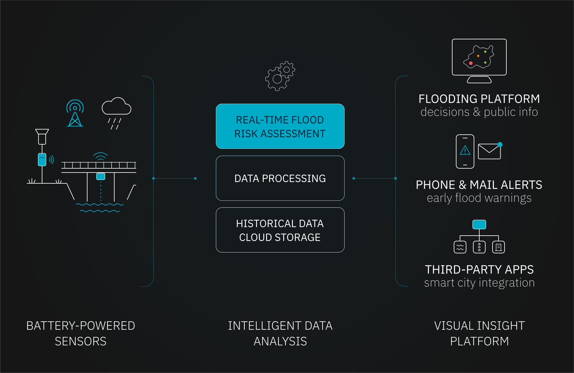
How it works?
FAQ
Interested in protecting your city and catchment from flooding?
Let’s discuss how we can tailor this flood monitoring system to your specific project.

